The Coastal Lagoons of Los Haitises National Park: Wetland Habitats, Water Levels and Biodiversity
Los Haitises National Park is famous for its limestone hills, mangrove forests, caves and winding coastal waterways. Another important part of its natural environment is its collection of wetland and shallow-water habitats.
These water-rich environments help connect the park's forests, karst landscape and coastal ecosystems. They provide places where aquatic plants grow, water collects and wildlife finds suitable feeding and shelter areas.
The word lagoon is often used broadly when describing shallow coastal water bodies. However, not every wetland in Los Haitises is technically a coastal lagoon. The park contains a wider mixture of wetlands, depressions, water bodies, mangrove channels and groundwater-connected environments.
Understanding these differences is important for appreciating the park's biodiversity and hydrology.
This guide explores the coastal and inland wetland environments associated with Los Haitises, how their water levels are influenced by natural processes, and why their conservation matters.
1. Understanding the Wetland and Lagoon Landscape of Los Haitises
Los Haitises is not a landscape made up of only dry limestone hills and forests. Its natural environment includes several types of water-related habitats.
The park's management plan describes a mosaic of natural environments that includes coastal cays, wetlands, coastal cliffs, limestone hills, depressions and valleys. It also identifies mangroves and wetlands as important conservation priorities.
The same management document includes water bodies, lagoons and lakes among the land-cover categories represented in its mapping.
These descriptions show that shallow-water environments are part of the park's wider ecological landscape.
However, it is important not to assume that all mapped water bodies are open coastal lagoons. Some may be freshwater wetlands, seasonal pools, inland depressions or other water features.
For visitors and nature enthusiasts, the most useful way to understand this landscape is as a network of connected wetland habitats rather than a collection of individually named lagoons.
2. How Limestone Geology Influences Water Collection
One of the most distinctive features of Los Haitises is its karst geology.
Karst landscapes develop when water gradually dissolves soluble rocks, especially limestone. Over long periods, this process creates depressions, underground passages, cavities and other distinctive landforms.
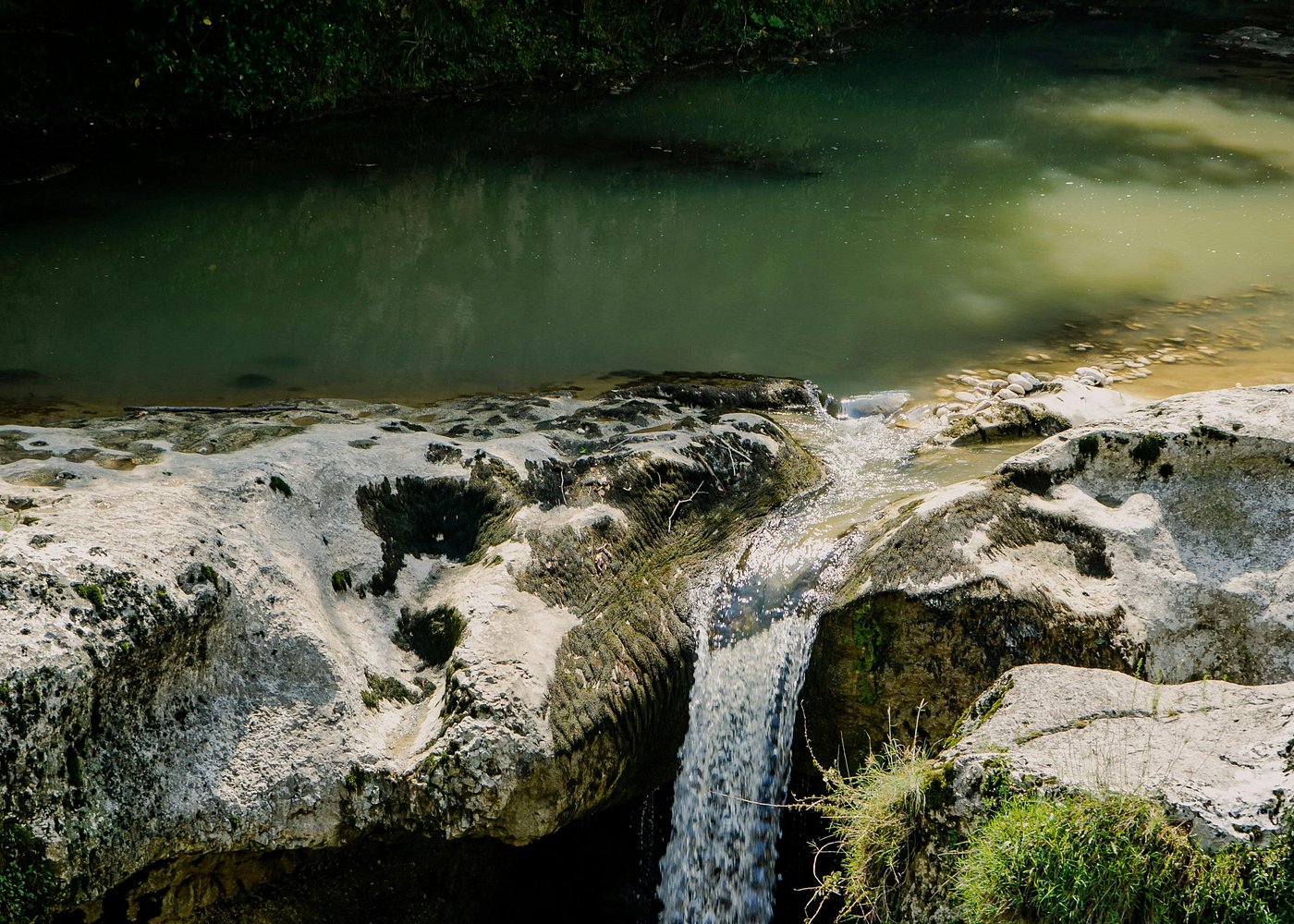
Rainwater can enter the ground through openings, fractures and depressions. Some water moves underground, while some collects in lower areas or reaches rivers and springs.
The park's management plan explains that much of the rainfall infiltrates through dolines and other natural openings, forming underground lakes and watercourses. Some groundwater reaches the coastal area, while other flows contribute to river systems.
This means that the visible water environment is only one part of the park's hydrological system.
A shallow wetland may be influenced by rainfall and groundwater even when no large river flows directly into it.
The karst landscape therefore plays an important role in determining where water collects and how it moves through Los Haitises.
3. Coastal Lagoons, Inland Wetlands and Mangrove Channels: What Is the Difference?
These three habitat types are related, but they are not interchangeable.
Coastal lagoons
A coastal lagoon is generally a shallow body of water separated partly or almost entirely from the open sea by a natural barrier, such as a sandbar, reef or coastal formation.
Depending on its connection with the sea, a lagoon may contain freshwater, brackish water or saltwater.
A lagoon's water conditions can change through rainfall, evaporation, tidal exchange and freshwater inflow.
Inland wetlands
Inland wetlands are areas where the soil remains saturated or is covered by water for part or all of the year.
They can include marshes, freshwater swamps, seasonal pools and wet depressions.
In a karst environment such as Los Haitises, some wetlands are connected to groundwater.
Mangrove channels
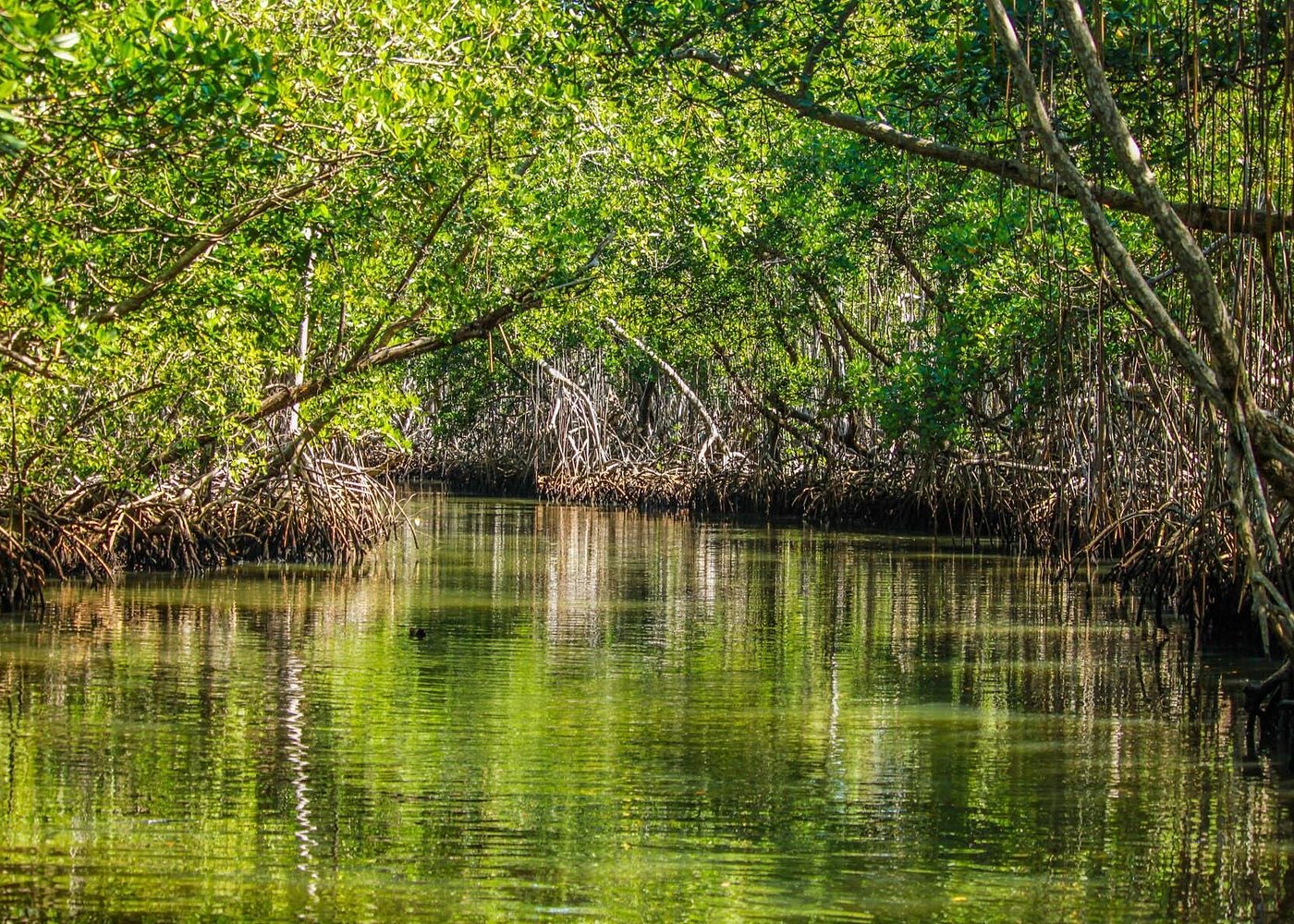
Mangrove channels are waterways that pass through or alongside coastal mangrove forests.
Their water levels and salinity can be influenced by tides, freshwater inputs and local drainage conditions.
These channels provide aquatic habitat and help maintain connections between different parts of the coastal ecosystem.
Recognizing these differences helps explain why Los Haitises has such a varied wetland landscape.
4. How Rainfall Influences Wetland Water Levels
Rainfall is one of the most important natural influences on the water environment of Los Haitises.
The park lies in a region known for relatively high rainfall. Its management plan reports historical average annual rainfall figures for surrounding reference locations, including approximately 2,017 millimetres for Sánchez, 1,714 millimetres for Cotuí and 1,589 millimetres for Hato Mayor.
These figures are regional reference measurements from the management document, not current measurements for every wetland inside the park.
Rainfall can influence wetlands in several ways:
- Directly adding water to shallow pools and depressions.
- Increasing soil saturation.
- Contributing water to groundwater recharge.
- Increasing runoff into low-lying areas.
- Influencing the flow of streams and springs.
The effect depends on local geology, drainage, vegetation and the depth of the wetland.
A shallow depression may respond quickly to heavy rain, while a groundwater-connected wetland may respond more gradually.
Seasonal changes in rainfall can therefore influence the appearance and extent of wetland habitats.
5. The Role of Groundwater in Los Haitises Wetlands
One of the most interesting features of Los Haitises is the relationship between wetlands and underground water.
A 2013 scientific study titled Humedales en Los Haitises, República Dominicana describes numerous wetlands in the park's karst environment that are linked to groundwater.
The researchers examined rivers, springs and wells. They measured water levels and collected samples for chemical and isotopic analysis to better understand the relationships between different water bodies.
The study found similarities in the chemical composition of the water bodies and identified evidence of evaporation in some rivers and shallow dug wells.
These findings demonstrate that the park's wetlands should not be understood as isolated surface-water features.
Some wetland environments are connected to a much larger underground system.
This relationship is particularly important in limestone landscapes, where water can move through hidden pathways that are not visible from the surface.
6. How Tides Can Influence Coastal Wetland Habitats
Coastal wetlands near the sea may experience changes in water level because of tides.
As seawater rises and falls, it can move through connected coastal channels and influence nearby mangrove environments.
Tidal movement may affect:
- The depth of water in coastal channels.
- The frequency and duration of wetland flooding.
- The movement of suspended sediment.
- Salinity conditions in coastal habitats.
- The movement of nutrients and organic material.
The influence of tides is not necessarily the same in every wetland.
A coastal mangrove channel with a direct connection to tidal water may respond differently from an inland freshwater depression.
This is why coastal and inland wetlands should be studied separately, even when they are part of the same broader park ecosystem.
7. Why Water Levels Change Throughout the Year
Wetland water levels are not fixed.
They can rise or fall as a result of several natural processes.
Rainfall variation
Periods of heavier rainfall can increase surface water and groundwater recharge. Drier periods may reduce water levels in some shallow wetlands.
Evaporation
Water exposed to sunlight and warm air can gradually evaporate. The effect can be particularly noticeable in shallow water bodies.
The 2013 Los Haitises wetland study identified evidence of evaporation in some of the sampled rivers and shallow wells.
Groundwater movement
Water entering and leaving the underground karst system can influence springs and groundwater-connected wetlands.
Tidal exchange
In coastal locations connected to the sea, tidal movement can influence water levels and salinity.
Local drainage
The shape of the land, vegetation and connections between channels can affect how quickly water enters or leaves a wetland.
Together, these processes create changing conditions that help determine which plants and animals can use each habitat.
8. Wetland Vegetation and Its Ecological Importance
Wetland vegetation is adapted to conditions that many ordinary terrestrial plants cannot tolerate.
Some species grow in permanently wet soil, while others survive where flooding occurs only during certain periods.
In Los Haitises, wetland vegetation forms part of a broader habitat mosaic that includes mangroves, freshwater swamp environments and other plant communities.
Mangroves are especially important in the coastal portions of the park.
The main mangrove species recorded in research from the wider Yuna–Barracote delta include:
- Red mangrove (Rhizophora mangle).
- White mangrove (Laguncularia racemosa).
- Black mangrove (Avicennia germinans).
These species are adapted to coastal conditions and should not be assumed to occur throughout every inland wetland.
Wetland vegetation provides several ecological functions. It offers shelter for animals, contributes organic material to aquatic food webs and helps stabilize wet soils.
Plants can also influence how water and sediment move through shallow habitats.
9. Wildlife That Uses Wetland Habitats
Wetlands are important habitats for many kinds of wildlife.
The combination of shallow water, aquatic vegetation, muddy surfaces and nearby forest creates different opportunities for feeding, shelter and movement.
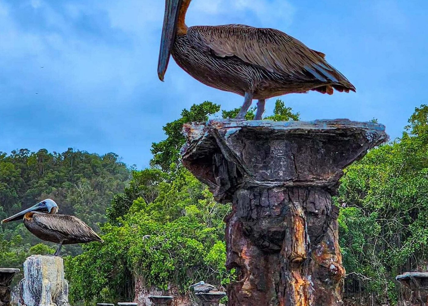
Wetland birds
Wading birds are particularly associated with shallow-water environments.
Depending on the habitat and location, birds such as herons and egrets may use wetland edges to search for fish and other aquatic organisms.
Other water-associated birds may feed or rest around marshes, channels and sheltered coastal areas.
Fish and aquatic organisms
Shallow wetlands and connected channels can provide habitat for fish and smaller aquatic organisms.
Some coastal mangrove environments are used by aquatic species for feeding and shelter.
Crabs and other invertebrates
Wetland soils and mangrove roots support a variety of invertebrates. Crabs and other small animals are important parts of the food web.
Reptiles and amphibians
Wet environments can also provide suitable conditions for some reptiles and amphibians. Actual species presence varies by habitat, and visitors should not assume that every species occurs in every wetland.
Wildlife observations depend on water conditions, season, vegetation and disturbance. A responsible visitor should enjoy wildlife without trying to approach, touch or feed it.
10. Why Wetlands Are Important for the Park's Water System
Wetlands are not simply areas where water collects. They form part of the wider hydrological system.
Their ecological functions can include:
Water storage: Wetland depressions and saturated soils can temporarily hold water.
Groundwater relationships: Some wetlands interact with underground water systems.
Habitat support: Wetlands provide living space for plants, birds and aquatic organisms.
Nutrient cycling: Wetland vegetation and microorganisms help process organic material and nutrients.
Floodwater movement: Connected low-lying habitats can influence how water moves across the landscape.
The exact importance of each function depends on the type and location of the wetland.
In Los Haitises, these functions are especially relevant because the park combines karst geology, substantial rainfall, mangroves and coastal waterways.
11. Threats to Wetland Habitats
Wetlands can be damaged when their natural water conditions or surrounding vegetation are altered.
The Los Haitises management plan identifies several pressures on the park's conservation values, including vegetation removal, fires, habitat destruction, uncontrolled visitation and pollution associated with some activities.
Potential pressures on wetland environments include:
- Pollution entering waterways.
- Removal or damage of wetland vegetation.
- Alteration of natural drainage.
- Excessive disturbance from visitors.
- Sediment or waste entering shallow habitats.
- Damage to surrounding forests and mangroves.
The management plan is from 2012–2017, so its threat descriptions should be understood as historical management documentation rather than a current assessment of every site.
Monitoring is important because wetland conditions can change over time.
Protecting water quality, maintaining natural drainage and preventing unnecessary disturbance are essential conservation priorities.
12. Can Visitors Explore the Wetlands of Los Haitises?
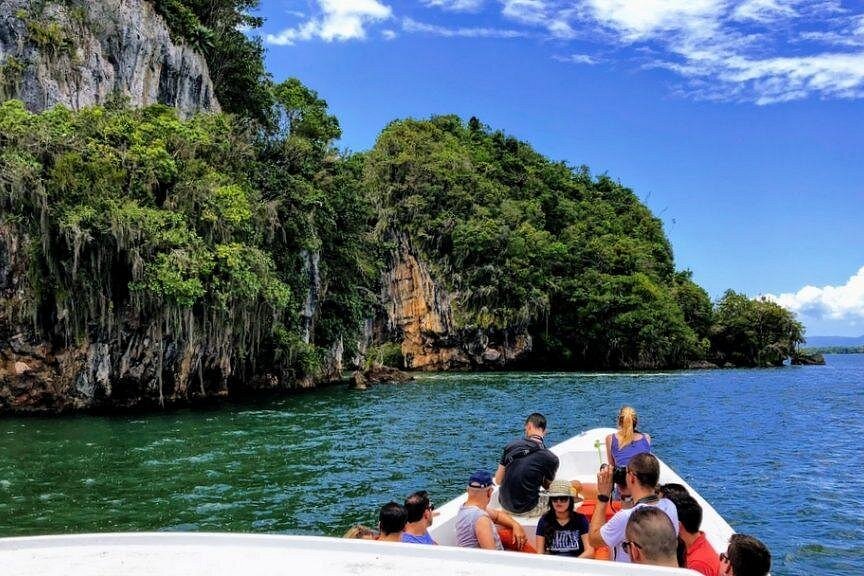
Visitors commonly experience Los Haitises through guided boat excursions and selected nature activities.
Boat trips can provide views of mangrove channels, coastal scenery, limestone formations and other natural features.
However, not every wetland or shallow-water area is an authorized visitor destination.
Some locations may be difficult to access, ecologically sensitive or outside designated public-use areas.
Before booking an excursion, ask the operator which areas are included and whether the route is currently authorized.
Visitors should follow responsible nature-viewing practices:
- Stay on authorized routes.
- Avoid entering restricted wetlands.
- Do not remove plants, shells or other natural objects.
- Never throw rubbish into the water.
- Avoid disturbing birds and other wildlife.
- Keep noise low near sensitive habitats.
- Follow the instructions of authorized guides.
Responsible tourism allows visitors to appreciate the park without damaging the environments that make it special.
13. Why Protecting Wetlands Matters for the Future of Los Haitises
The wetlands of Los Haitises are important because they connect different parts of the park's natural environment.
They are influenced by rainfall, groundwater, surface drainage and coastal processes. Their vegetation and water conditions support a range of habitats for wildlife.
The park's management plan identifies wetlands, mangroves and the underground aquifer among the natural resources that require protection.
Conservation therefore needs to consider both visible water bodies and the underground systems that influence them.
Protecting wetlands means maintaining natural water movement, preventing pollution, preserving vegetation and reducing unnecessary disturbance.
These actions help protect the ecological connections that make Los Haitises one of the Dominican Republic's distinctive natural landscapes.
Frequently Asked Questions
1. Does Los Haitises National Park have lagoons?
The park's management documentation includes lagoons, lakes and other water bodies in its land-cover mapping. However, the park contains a wider range of wetland types, and not every water body should be described as a coastal lagoon.
2. What is the difference between a lagoon and a wetland?
A lagoon is generally a shallow water body associated with a coastal setting. A wetland is a broader term for land that is saturated or covered by water for part or all of the year.
3. Are the wetlands of Los Haitises connected to groundwater?
Yes. A 2013 scientific study describes numerous wetlands in the karst environment of Los Haitises that are linked to groundwater.
4. Does rainfall affect the water levels?
Yes. Rainfall can add water directly to wetlands, increase runoff and contribute to groundwater recharge. The effect varies according to local geology and drainage.
5. Do tides affect every wetland in Los Haitises?
No. Tidal influence is most relevant to coastal habitats with a connection to seawater. Inland freshwater wetlands may respond more strongly to rainfall and groundwater.
6. What plants grow in Los Haitises wetlands?
Wetland vegetation varies by habitat. Coastal mangroves include red, white and black mangroves in documented areas, while inland wetlands support different plant communities.
7. What wildlife can be found in wetland habitats?
Wetlands can support birds, fish, crabs and other aquatic organisms. The species observed depend on the specific habitat and environmental conditions.
8. Are the wetlands important for groundwater?
Yes. Scientific research describes connections between wetlands and groundwater in the park's karst environment.
9. Can tourists visit every lagoon or wetland?
No. Visitors should use authorized routes and confirm access with park authorities or an authorized tour operator.
10. Why should the wetlands of Los Haitises be protected?
They support biodiversity, interact with groundwater and coastal systems, and help maintain the ecological functions of the park.
Conclusion
The coastal and inland wetland environments of Los Haitises are an important part of the park's natural identity.
Their water levels are influenced by rainfall, groundwater movement, evaporation, local drainage and, in connected coastal habitats, tides. These changing conditions help create habitats for vegetation, birds and aquatic organisms.
The park's wetlands are also connected to its limestone geology and underground water system. This makes them more complex than isolated pools or shallow water bodies.
Protecting these environments means conserving the water, vegetation and natural connections that sustain them. For visitors, understanding this relationship offers a deeper appreciation of the ecological importance of Los Haitises National Park.
Local explorer & expert guide in Samana Whale Watching Tour.