The Yuna River Delta and Los Haitises National Park: Sediment, Mangroves and Coastal Change
The coastal landscape around Los Haitises National Park is shaped not only by limestone hills, caves and mangrove forests but also by the movement of rivers and sediment. One of the most important geographical features connected to this landscape is the delta of the Yuna River.
As the Yuna approaches Samaná Bay, it carries water and sediment from a large inland drainage basin. When the river reaches the low-gradient coastal plain, its flow slows and sediment can accumulate. Over long periods, these deposits contribute to the development of wetlands, marshes, channels and changing coastal landforms.
The Yuna River delta is particularly relevant to Los Haitises because its southern and eastern margins connect with the park's coastal environment, including the area around the Barracote River mouth.
Understanding this relationship helps explain how river processes influence mangroves, wetlands and coastal habitats around the park.
This guide explores how the Yuna delta formed, how sediment moves through the river system, and why changes in the delta matter to the natural environment of Los Haitises.
1. What Is the Yuna River Delta?
A river delta is a landform created when a river deposits sediment near its mouth. As the river enters a slower-moving body of water, such as a bay or sea, its ability to carry sediment may decrease. Some of the material settles, gradually building new deposits.
Deltas often contain a combination of:
- River channels and smaller distributaries.
- Muddy and sandy deposits.
- Wetlands and marshes.
- Shallow water and flooded lowlands.
- Mangrove forests in suitable tropical coastal areas.
- Areas of recently deposited sediment.
The Yuna River delta is part of the low-lying coastal landscape associated with Samaná Bay and the nearby Bahía Escocesa region.
Geological mapping of the Sánchez area describes a broad deltaic landscape extending from the Caño Estero Hondo area toward the Barracote River, near the southern boundary of the delta and the Los Haitises region. The mapped landscape includes extensive marshes and low-lying wetlands.
This is a much broader geographical system than a single river mouth. Its processes influence coastal habitats connected with Los Haitises.
2. Where the Yuna Delta Meets the Los Haitises Landscape
Los Haitises occupies part of the southern side of Samaná Bay. Its limestone landscape and coastal wetlands meet a low-lying river-influenced environment to the west.
The Yuna and Barracote rivers are important to this connection.
The Yuna transports freshwater and sediment from its inland basin toward the bay. The Barracote reaches the coastal environment close to Los Haitises. Research on mangrove vegetation in the park has examined the broad delta formed around the mouths of these two rivers.
This relationship creates a transition between several environments:
- The river channels that carry freshwater.
- The deltaic lowlands where sediment accumulates.
- Mangrove forests growing in suitable coastal conditions.
- Wetlands and marshes in low-lying areas.
- The tidal and marine waters of Samaná Bay.
These environments are connected, but they are not identical. The delta includes areas beyond the national park, and not every part of the Yuna's lower course should be described as being inside Los Haitises.
3. How the Yuna River Builds Its Delta
The development of a river delta is a gradual process involving erosion, transportation and deposition.
Step 1: Sediment enters the river
Rainfall and surface runoff move soil and weathered rock material from the river basin into streams and tributaries.
The sediment may include clay, silt, sand and organic particles.
Step 2: The river transports the material downstream
As water flows through the river system, it carries suspended sediment and may also move larger particles along the riverbed.
The quantity transported varies with river discharge, rainfall, land cover and the availability of loose material.
Step 3: The river approaches the coastal plain
Near the lower course, the landscape becomes flatter. The river's gradient decreases, and its flow conditions change.
The river may spread through channels and low-lying areas before reaching the bay.
Step 4: Sediment settles
When water slows, some suspended material settles onto the riverbed, banks and surrounding lowlands.
Fine particles may accumulate in sheltered areas, while stronger currents can transport them farther toward the coast.
Step 5: Deposits gradually change the landscape
Repeated deposition can build up low-lying land and alter the shape of channels and wetlands.
The process is not one-directional. Erosion, tides, waves, storms and changes in river flow can also remove or redistribute previously deposited material.
The Yuna delta is therefore a changing landscape rather than a fixed landform.
4. Why the Yuna Carries Sediment Toward Samaná Bay
The Yuna River drains a large inland basin. Water moving through this basin collects material from soils, riverbanks and tributaries.
Several factors influence how much sediment reaches the lower river.
Rainfall and runoff
Heavy rainfall increases surface runoff and can wash loose soil into streams. Higher river discharge may transport larger quantities of sediment toward the coast.
Natural erosion
Soil and rock are naturally eroded by rainfall, flowing water and other weathering processes. This material can become part of the river's sediment load.
Changes in land use
Deforestation, agriculture, mining, construction and poorly managed land disturbance can increase erosion in some locations.
A study of sedimentation in Samaná Bay identified human activities, including mining, deforestation, agriculture and urban development, as important contributors to increased sediment delivery in the wider river-and-bay system.
The effect of each activity depends on its location, scale and management.
5. What Happens When River Sediment Reaches the Coast?
When sediment reaches the lower Yuna and Samaná Bay, it does not all settle in one place.
Its movement depends on particle size, water depth, current strength, tides, waves and the shape of the coastline.
Fine sediment
Clay and fine silt can remain suspended in the water for longer periods. They may settle in sheltered areas when water movement becomes weaker.
Sand
Sand generally settles more quickly than fine silt and clay. It can accumulate along riverbanks, shallow channels and coastal deposits.
Organic material
River water may also carry decomposing plant material and other organic particles. These can become part of the sediment deposited in wetlands and coastal environments.
Coastal redistribution
Tidal currents, waves and storms can move previously deposited material. Sediment may therefore be transported away from the immediate river mouth and deposited elsewhere along the coast.
This is one reason why the shape of the Yuna delta cannot be explained by river flow alone. Coastal processes also play an important role.
6. How Sediment Deposition Changes the Coastal Landscape
As sediment accumulates, it can change the elevation and shape of low-lying coastal areas.
The effects may include:
- Gradual formation of new sediment deposits.
- Changes in the depth of shallow channels.
- Development or expansion of muddy wetlands.
- Changes in the position of river channels.
- Alteration of coastal shorelines.
- Accumulation of fine material in sheltered water bodies.
A geomorphological assessment of the Sánchez region describes the Yuna delta as an area of substantial sediment accumulation. It identifies extensive marshes and low-lying wetlands within the deltaic plain.
These landforms are important to the broader landscape surrounding Los Haitises because they form part of the coastal transition between the river basin and the national park.
7. The Relationship Between the Yuna Delta and Mangrove Forests
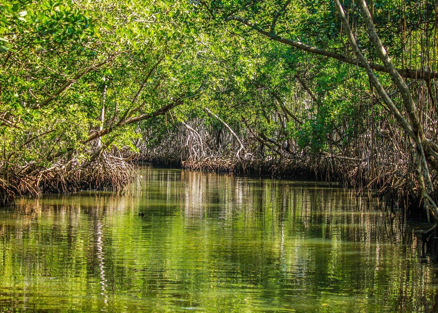
Mangroves are an important feature of the coastal environment near the Yuna and Barracote river mouths.
A scientific study conducted inside Los Haitises examined a mangrove forest in the broad delta created by these two rivers. The study area was dominated by red mangrove, with white mangrove and smaller amounts of black mangrove also present.
Mangroves and deltaic sediment processes are closely connected.
Mangrove roots interact with sediment
Mangrove roots create physical resistance to moving water. In suitable conditions, this can slow water movement and allow some suspended particles to settle.
Sediment provides growing surfaces
Mangrove seedlings and propagules need suitable surfaces and conditions to establish. The type, stability and elevation of sediment influence where regeneration can occur.
Mangroves influence the local shoreline
Roots can help hold soft sediment together and reduce erosion in some settings. However, the effectiveness of this protection depends on forest condition, water movement and coastal exposure.
Excessive sediment can also cause problems
Mangroves need suitable flooding and drainage conditions. Very rapid sediment accumulation can alter ground elevation and water movement, potentially affecting established vegetation and regeneration.
The relationship is therefore not simply that more sediment always benefits mangroves. Natural sediment processes are important, but the rate and location of deposition also matter.
8. Why Sediment Changes Matter to Wetlands
The Yuna delta contains low-lying wetlands and marshes that are influenced by river water and coastal processes.
Sediment accumulation can gradually change the depth of these areas and the conditions under which water moves through them.
For example, deposition may make some shallow areas less deep. It may also alter channels that connect wetlands with rivers and coastal water.
Wetland vegetation responds to changes in flooding, water depth and sediment conditions. Different plants grow in different environments, so changes in elevation and water movement can influence habitat distribution.
These processes are relevant to the wider Los Haitises landscape because the park contains wetlands and mangrove areas connected to coastal drainage systems.
9. What Scientific Research Says About Sedimentation in Samaná Bay
Research published in 2020 examined sediment accumulation in Samaná Bay using sediment cores and historical information.
The study reported that the Yuna River contributed substantial sediment to the bay. Its analysis of changes from 2003 to 2019 estimated that Yuna-related sediment deposits occupied approximately 2.38 square kilometres of bay area, with an average sediment accumulation rate of about 1.78 centimetres per year in the studied context.
These figures describe the research's interpretation of sediment deposition in the wider bay. They should not be understood as a current measurement of the entire delta or of every coastal site inside Los Haitises.
A separate 2019 study also examined the effects of extreme weather events on sedimentation in Samaná Bay. It discussed the role of river runoff, storms and hurricanes in changing the amount of sediment transported into the bay.
Together, these studies show that the coastal landscape is influenced by both natural processes and human activities in the wider watershed.
10. How Storms and Hurricanes Influence the Delta
Storms and hurricanes can produce major changes in river and coastal environments.
Heavy rainfall increases runoff and may raise river discharge. Strong currents can transport additional sediment from upstream areas toward the delta.
At the coast, waves and storm-driven water movement can redistribute sediment already deposited near the river mouth.
These processes may:
- Increase suspended sediment in the water.
- Deposit new material in low-lying areas.
- Erode exposed banks and shorelines.
- Change the depth or position of channels.
- Disturb mangrove edges and other coastal habitats.
The effect of a storm depends on its rainfall, intensity, duration, path and the condition of the river basin.
Not every storm creates the same result. Some locations may receive additional sediment, while others may experience erosion or redistribution.
11. How Human Activities Can Increase Sediment Pressure
Natural sediment movement is part of delta development. However, activities in the river basin can increase the amount of material reaching the coast.
Deforestation
Removing trees and other vegetation can expose soil to rainfall and runoff. This may increase erosion, especially on disturbed slopes.
Mining and excavation
Mining and excavation can expose loose earth and rock. If disturbed areas are not properly managed, sediment may enter nearby drainage systems.
Agriculture
Agricultural land can contribute sediment when soil is exposed or when runoff is poorly controlled.
Construction and urban expansion
Road building, land clearing and construction may increase erosion if drainage and soil protection are inadequate.
These activities do not have identical impacts everywhere. Their contribution depends on land management, location and the effectiveness of erosion controls.
12. Why Protecting the Yuna Delta Matters to Los Haitises
The ecological importance of the Yuna delta extends beyond the river mouth itself.
Its sediment, freshwater and coastal connections influence habitats around the western part of Samaná Bay, including mangrove and wetland environments connected to Los Haitises.
Protecting this wider system involves:
- Reducing avoidable soil erosion throughout the river basin.
- Improving the management of mining and construction areas.
- Protecting natural vegetation along waterways.
- Reducing the amount of untreated waste entering rivers.
- Monitoring sediment accumulation and water quality.
- Conserving mangroves and wetlands.
- Maintaining natural connections between rivers and coastal habitats.
Conservation in Los Haitises is more effective when the park is considered part of a larger river-and-coast system.
13. Observing the Deltaic Landscape During a Los Haitises Visit
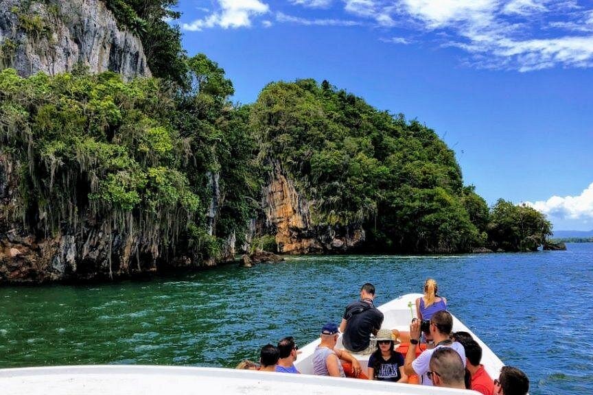
Visitors exploring the authorized coastal routes of Los Haitises may notice the relationship between mangroves, shallow waterways, wetlands and the wider bay.
Although a boat excursion does not necessarily pass through every part of the Yuna delta, it can help visitors understand the park's coastal setting.
Look for:
- Mangrove forests along sheltered waterways.
- Muddy or shallow coastal areas.
- Changes in the width and depth of channels.
- River-influenced coastal scenery.
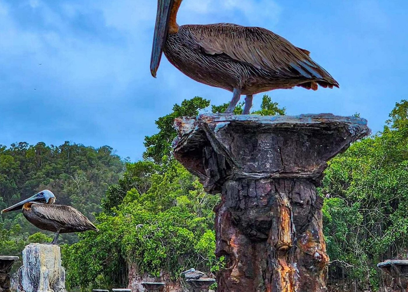
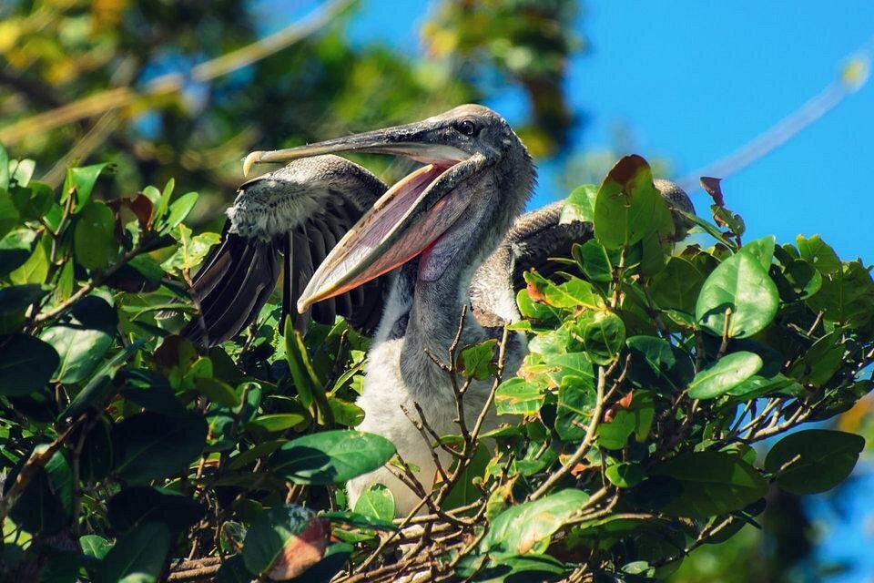
- Birds using mangrove and wetland habitats.
- Differences between enclosed waterways and more open bay environments.
The colour of the water alone cannot establish how much sediment is present. Water appearance is also influenced by light, depth, organic matter and weather.
Visitors should remain on authorized routes and avoid entering sensitive wetlands or mangrove areas without permission.
Frequently Asked Questions
1. What is the Yuna River delta?
It is a broad low-lying coastal landform created by sediment carried and deposited by the Yuna River. It includes river channels, wetlands, marshes and coastal deposits.
2. Is the Yuna River delta inside Los Haitises National Park?
The delta is a broader geographical system that extends beyond the park. Its southern and eastern coastal areas connect with Los Haitises, particularly near the Barracote River mouth.
3. Why does the Yuna River carry so much sediment?
The river drains a large basin and receives sediment from natural erosion, rainfall runoff and disturbed land. The amount transported changes with river flow and land-use conditions.
4. How does sediment create a delta?
When a river reaches slower-moving coastal water, some of its suspended sediment settles. Repeated deposition can build low-lying land and alter channels over time.
5. What is the connection between the Yuna delta and mangroves?
Mangrove forests grow in suitable coastal areas near the river mouths. Their roots interact with sediment and water movement, while river deposits help shape the physical environment in which mangroves grow.
6. Can too much sediment damage mangroves?
Yes. Rapid or excessive deposition can change ground elevation, flooding and drainage conditions. The effects depend on the amount of sediment and the characteristics of the mangrove site.
7. Do hurricanes affect the Yuna delta?
Heavy rainfall and coastal disturbances associated with storms can increase sediment transport, cause erosion and redistribute deposits around the delta and bay.
8. Does the Yuna delta affect Samaná Bay?
Yes. River water and sediment influence the bay's coastal environment. Scientific studies have examined the role of Yuna sediment in changing parts of the bay.
9. Can visitors see the Yuna River delta on a Los Haitises tour?
Not every Los Haitises excursion visits the Yuna delta itself. Tour routes vary, but some authorized trips explore coastal waterways and mangrove scenery connected to the wider river-and-bay environment.
10. How can the delta be protected?
Reducing soil erosion, managing land disturbance, protecting mangroves, controlling pollution and monitoring river sediment are important conservation measures.
Conclusion
The Yuna River delta is an important part of the coastal landscape connected to Los Haitises National Park. Over time, the river has transported sediment from its inland basin toward Samaná Bay, helping form low-lying deposits, marshes and wetlands.
These processes influence the physical environment around the Yuna and Barracote river mouths, where mangrove forests and other coastal habitats are found.
The delta continues to change through the combined effects of river flow, sediment deposition, tides, storms and human activities in the watershed.
Understanding this relationship helps explain why the conservation of Los Haitises cannot be separated entirely from the rivers and coastal landscapes surrounding it. Protecting the park's mangroves and wetlands also requires attention to the natural processes and land-use decisions that shape the wider delta system.
Local explorer & expert guide in Samana Whale Watching Tour.