The Estuary Ecosystem of Los Haitises National Park: Where River Water Meets the Sea
Where a river reaches the coast, freshwater begins interacting with seawater. This meeting creates a special environment known as an estuary. Water conditions can change over short distances, sediment moves through channels, and plants and animals must adapt to a mixture of freshwater and saltwater influences.
Around Los Haitises National Park, estuarine processes are especially relevant to the coastal landscapes connected with Samaná Bay. The Yuna and Barracote rivers reach the bay near the western part of the park's coastal environment, while other waterways, including the Caño Hondo River, connect park landscapes with coastal waters around San Lorenzo Bay.
These river mouths and connected coastal habitats form part of a wider ecological system involving mangroves, wetlands, tidal channels and marine environments.
An estuary is not simply the point where a river ends. It is a changing environment where water, sediment, nutrients and living organisms move between inland and coastal habitats.
This guide explains how estuaries work, how freshwater and seawater interact around Los Haitises, and why these transition zones are important for the park's coastal ecology.
1. What Is an Estuary?
An estuary is a coastal water environment where freshwater from rivers mixes with seawater from the ocean or a connected bay.
The mixing process creates conditions that differ from those found in a freshwater river or fully marine environment.
Estuaries may contain:
- River channels.
- Tidal channels.
- Muddy shorelines.
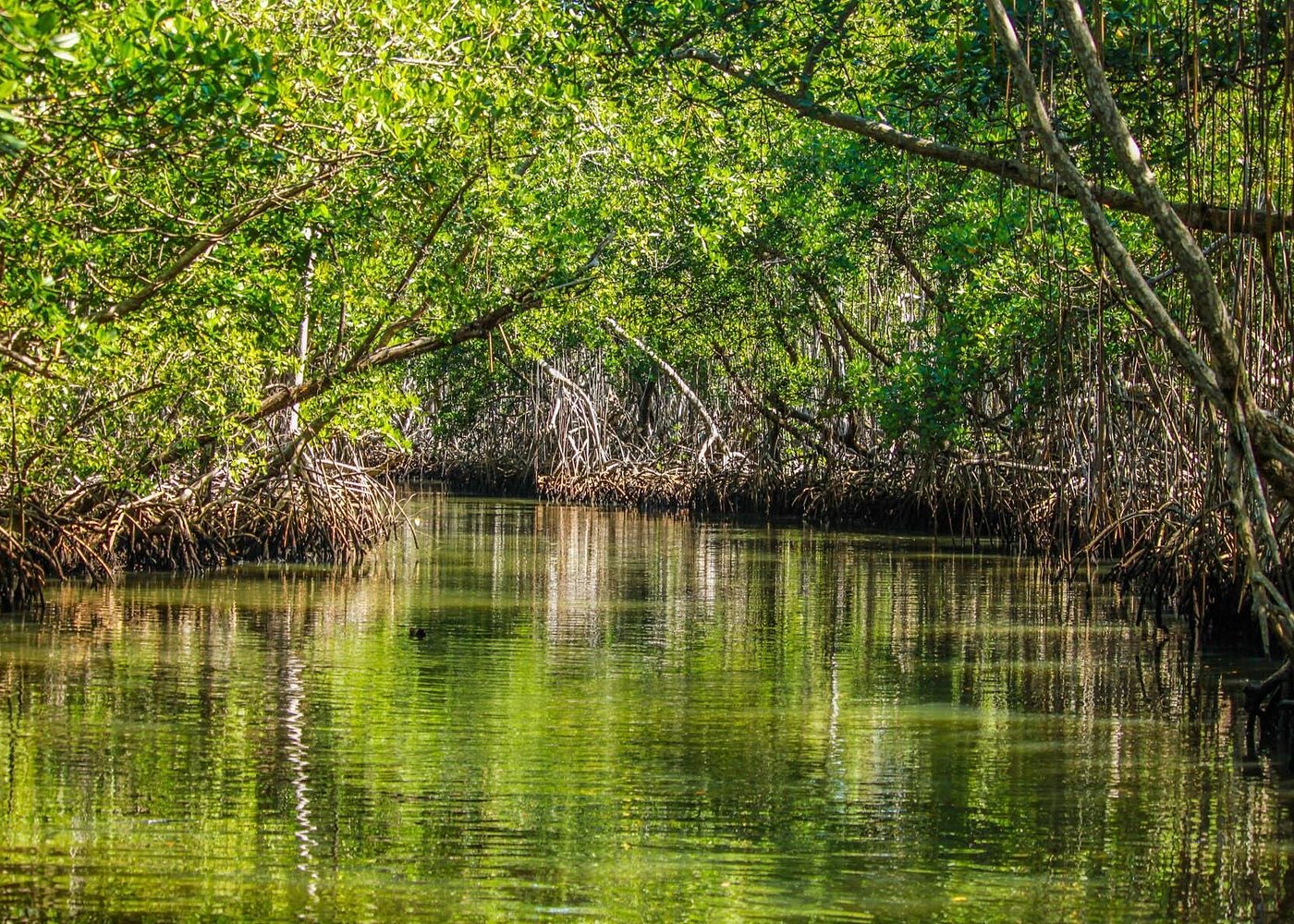
- Mangrove forests.
- Shallow coastal water.
- Wetlands and marshes.
- Areas where freshwater and saltwater mix.
Not every estuary has the same shape. Some have wide river mouths, while others contain narrow channels, sheltered bays or complex networks of tidal waterways.
The defining feature is the interaction between river water and coastal seawater.
In the Los Haitises region, the coastal waters of Samaná Bay receive freshwater and sediment from several rivers. The resulting estuarine environment is closely connected to the park's mangrove and wetland habitats.
2. Where Are the Estuarine Environments Connected to Los Haitises?
The park's coastal setting is linked to several important river and bay systems.
The Yuna River mouth
The Yuna is one of the major rivers flowing into Samaná Bay. Its lower course reaches the bay through a broad lowland and deltaic landscape.
Freshwater from the river carries suspended sediment and other material toward the coast. At the river mouth, this freshwater interacts with tidal and marine water.
The Yuna's influence extends beyond the immediate river channel because sediment and freshwater can affect surrounding coastal habitats.
The Barracote River mouth
The Barracote is another important river in the western part of Samaná Bay. Scientific research has examined the mangrove forest located in the broad delta formed by the mouths of the Yuna and Barracote rivers, within Los Haitises National Park.
This research site demonstrates the close relationship between river-mouth environments and mangrove ecosystems.
San Lorenzo Bay and the Caño Hondo River
San Lorenzo Bay is another important coastal area associated with Los Haitises. The Caño Hondo River flows toward the bay, connecting inland water systems with coastal habitats.
Research on sedimentation in the wider bay has also examined material deposited by the Caño Hondo River.
These locations should not be treated as one continuous river mouth. They are separate parts of the wider coastal drainage and estuarine landscape connected to Los Haitises.
3. How Freshwater and Seawater Mix
The interaction between freshwater and seawater is one of the defining processes in an estuary.
Freshwater enters from rivers, streams and rainfall runoff. Seawater enters from the coast through tidal movement and other water circulation processes.
Because freshwater is generally less dense than seawater, it may remain nearer the surface in some estuarine conditions. Saltier water may move farther inland along the bottom of deeper channels.
However, this arrangement is not always present. Strong currents, wind, tides, river discharge and channel depth can mix the water more thoroughly.
The role of river discharge
When rainfall increases in a river basin, freshwater discharge may rise. More freshwater can enter the coastal environment, changing salinity and water movement.
The role of tides
Tides bring coastal water into connected channels and move water back toward the bay as levels fall. This affects how far seawater travels into an estuarine system.
The role of wind and currents
Wind and water currents can influence the direction and intensity of mixing. Their effects depend on the shape of the bay, water depth and local weather.
The result is an estuary where water conditions can change from hour to hour and from one location to another.
4. Understanding Salinity in the Estuary
Salinity is the amount of dissolved salt in water. It is one of the most important factors influencing estuarine habitats.
A river usually contains much less salt than seawater. When the two meet, the resulting water may have an intermediate salinity.
This mixture is often called brackish water.
Freshwater zones
Areas closer to the river's upper reaches generally receive a stronger freshwater influence, although tidal effects may extend inland along connected channels.
Brackish-water zones
Where river water and seawater mix, salinity can vary considerably. These transition areas are important because many estuarine organisms are adapted to changing salt concentrations.
More marine-influenced zones
Closer to the open bay, coastal seawater may have a stronger influence, although freshwater discharge can still affect local conditions.
These zones do not have fixed boundaries. Their position can shift with rainfall, river flow, tidal stage and weather.
For this reason, it would be inaccurate to assign one salinity value to the entire Los Haitises coastal environment.
5. Why Estuaries Support Mangrove Forests
Mangroves are adapted to coastal environments where water levels and salinity can change.
Their ability to tolerate salty or brackish conditions allows them to grow in suitable parts of estuaries and sheltered coastal areas.
A scientific study of the mangrove forest near the Yuna and Barracote river mouths inside Los Haitises found that red mangrove dominated the study area. White mangrove was also present, together with a smaller amount of black mangrove.
These trees occupy a landscape influenced by river water, coastal tides and wetland conditions.
Mangrove roots help stabilize soft sediment and create complex underwater structures. These structures provide habitat for small aquatic organisms and influence how water moves through the forest.
The connection between estuaries and mangroves is therefore both physical and ecological: estuarine water conditions help shape where mangroves grow, while mangrove forests influence the coastal environment around them.
6. How Estuaries Move Sediment
Rivers transport material from inland areas toward the coast.
This material can include:
- Fine clay particles.
- Silt.
- Sand.
- Organic matter.
- Naturally occurring minerals.
- Material carried during heavy rainfall and storms.
When river water reaches an estuary, its speed and direction may change. As the water slows in some areas, suspended particles can settle.
Tidal currents may then redistribute sediment through channels and shallow coastal areas.
Sediment deposition
Fine particles can accumulate in sheltered locations, including river-mouth environments and mangrove areas.
Sediment movement
Stronger currents, waves and storms can move previously deposited material.
Changes to river mouths
Over time, repeated sediment deposition can alter channels, shallow areas and the shape of the coastline.
Research published in 2020 examined sedimentation in Samaná Bay and reported substantial sediment accumulation associated with the Yuna River. The study linked increased sediment input to runoff and human activities in the river basin, including mining, deforestation, agriculture and urban development.
These findings describe the wider bay and river system, not a measurement of sediment conditions at every site inside the national park.
7. Why Estuaries Are Important for Fish and Aquatic Organisms
Estuaries provide a range of habitats for aquatic life.
Their channels, shallow water, muddy bottoms and mangrove roots offer different feeding and shelter opportunities.
Fish habitat
Some fish species use estuaries for feeding, shelter or parts of their life cycle. Juvenile fish may benefit from shallow areas where roots and vegetation provide cover.
Other species move between estuaries and marine waters as they grow or respond to changing environmental conditions.
Crustaceans
Crabs and other crustaceans can occupy muddy banks, mangrove roots and shallow channels. Their feeding and shelter needs vary by species.
Molluscs
Some molluscs live on submerged surfaces or within coastal sediment. Their distribution is influenced by salinity, water movement and the availability of suitable habitat.
Plankton
Plankton includes tiny drifting organisms in the water. These organisms form important parts of aquatic food webs and can respond to changes in nutrients, salinity and water circulation.
The presence and abundance of particular species vary by location and season. It is better to describe the estuary as a habitat supporting diverse aquatic communities than to assume every species occurs in every channel.
8. The Role of Nutrients in Estuarine Productivity
Rivers carry nutrients from inland landscapes toward coastal waters. These nutrients can enter estuaries through natural runoff and the breakdown of organic material.
In suitable quantities, nutrients help support the growth of microscopic algae and other primary producers.
These organisms form the base of many aquatic food webs.
Organic material from mangrove leaves, river vegetation and other sources can also enter the estuarine system. Microorganisms break down some of this material, making nutrients available to other parts of the ecosystem.
However, more nutrients do not always mean a healthier estuary. Excessive nutrient inputs from pollution or poorly managed land use can contribute to unwanted algal growth and low oxygen conditions.
Healthy estuaries depend on a balance of freshwater flow, nutrient supply, water circulation and habitat protection.
9. Estuaries and Coastal Birds
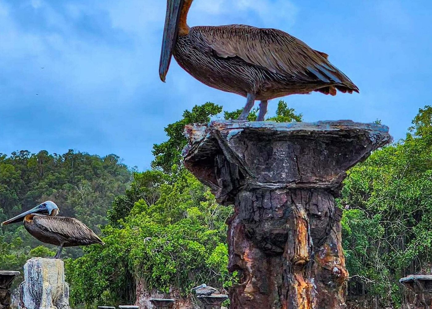
The shallow waters, mudflats, mangrove edges and sheltered channels associated with estuaries can provide feeding opportunities for birds.
Different birds use these environments in different ways.
- Herons and egrets may search for fish and other small aquatic animals in shallow water.
- Pelicans may feed in coastal waters where suitable fish are available.
- Shorebirds may forage on exposed muddy surfaces for small invertebrates.
- Frigatebirds and other coastal birds may use the broader bay environment for feeding and movement.
The habitats around Los Haitises are part of a wider coastal landscape used by resident and migratory birds.
Visitors should observe wildlife from a respectful distance and avoid disturbing feeding or resting birds.
10. How Rainfall and Storms Change Estuaries
Estuaries are naturally variable environments. Rainfall and storms can cause particularly noticeable changes.
Heavy rainfall
Heavy rain can increase river discharge, raise water levels and carry more sediment into coastal areas.
It can also reduce salinity in parts of the estuary as additional freshwater enters the system.
Tropical storms and hurricanes
Strong storms can produce intense runoff, waves and coastal water movement. They may move sediment, damage vegetation and alter river-mouth channels.
A study of Samaná Bay documented how extreme weather events and changes in runoff influenced sediment deposition.
Dry periods
During periods of lower river flow, seawater may have a stronger influence in some lower estuarine areas. Evaporation can also affect salinity in shallow or poorly flushed locations.
These processes help explain why the estuarine environment is always changing rather than remaining in one fixed condition.
11. Threats to the Estuary Ecosystem
Estuaries are connected to both inland and coastal environments. This means activities far upstream can affect the water reaching the coast.
Deforestation in river basins
Removing vegetation from land can increase soil erosion and the amount of sediment transported into rivers.
Mining and land disturbance
Poorly managed mining and other land-disturbing activities can increase sediment movement and may introduce pollutants into waterways.
Agricultural runoff
Fertilizers, pesticides and soil particles can enter rivers through runoff. Their effects depend on the substances involved and the quantity reaching the water.
Wastewater and solid waste
Untreated wastewater and discarded plastic can reduce environmental quality and harm aquatic organisms.
Altered freshwater flow
Dams, drainage changes, water extraction and other modifications can alter how much freshwater reaches coastal habitats.
Damage to mangroves
Mangrove removal can reduce habitat structure, disturb sediment and weaken some natural coastal protection functions.
Protecting estuaries therefore requires attention to the entire connected river and coastal system.
12. How Estuaries Can Be Protected
Maintaining healthy estuaries requires actions both inland and along the coast.
Important conservation measures include:
- Protecting natural mangrove forests and allowing damaged areas to regenerate.
- Reducing erosion and unnecessary land disturbance in river basins.
- Managing agricultural and wastewater runoff.
- Preventing the dumping of plastic and other waste into rivers and coastal channels.
- Maintaining natural water connections between rivers, wetlands and coastal areas.
- Monitoring sediment movement and water quality.
- Supporting responsible tourism and environmental education.
For Los Haitises, protecting the coastal environment means recognizing that the health of mangroves and estuarine habitats is influenced by conditions beyond the immediate shoreline.
13. Observing Estuarine Landscapes During a Los Haitises Visit
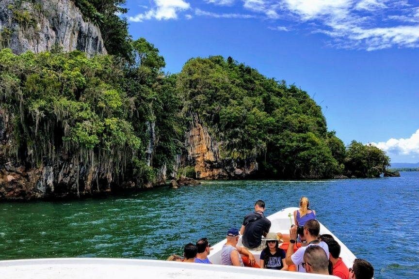
Visitors exploring Los Haitises by authorized boat excursions may see parts of the park's coastal waterways, mangrove forests and sheltered bays.
These landscapes provide opportunities to notice how rivers, wetlands and coastal waters connect.
During a visit, look for:
- Places where a river channel widens toward coastal water.
- Mangroves growing along sheltered shorelines.
- Differences between muddy riverbanks and more open coastal water.
- Sediment carried by water after rainfall.
- Birds feeding along shallow edges.
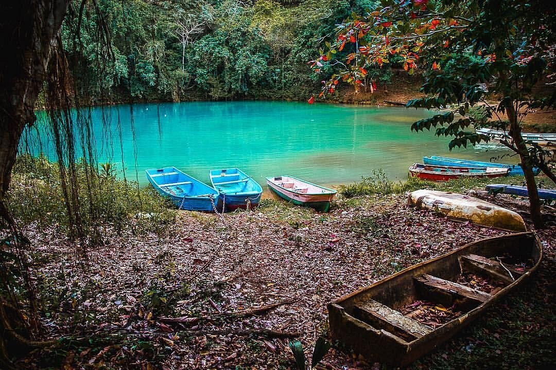
- Changes in water colour and clarity.
Water colour alone cannot reliably identify salinity or pollution. It may also be influenced by sediment, organic matter, depth, light and weather.
Visitors should remain on authorized routes, follow guide instructions and avoid disturbing sensitive habitats.
Frequently Asked Questions
1. What is an estuary?
An estuary is a coastal environment where freshwater from rivers meets and mixes with seawater. It often contains changing salinity, tidal channels, wetlands and mangroves.
2. Does Los Haitises have estuarine environments?
Yes. The coastal landscape connected with Los Haitises includes river-mouth and bay environments influenced by freshwater and seawater, particularly around the Yuna and Barracote river mouths and other connected coastal waterways.
3. Which rivers are important to the estuarine environment around Los Haitises?
The Yuna and Barracote rivers are important to the western part of Samaná Bay. The Caño Hondo River is also relevant to the coastal environment around San Lorenzo Bay.
4. What is brackish water?
Brackish water is water containing a mixture of freshwater and seawater. Its salinity is generally between that of freshwater and seawater, but it can vary widely.
5. Why are estuaries important for mangroves?
Estuaries provide coastal conditions where mangroves can grow. Their water and sediment conditions influence mangrove distribution, while mangrove roots help create habitat and stabilize some coastal sediments.
6. Do fish use estuaries as nursery habitats?
Some fish species use estuarine habitats during early life stages because shallow water and vegetation can provide shelter and feeding opportunities. The importance of a particular estuary varies by species.
7. Why does estuary water sometimes look muddy?
Rivers and coastal currents carry suspended sediment. When water slows, some particles settle, while stronger currents can stir them up again.
8. Can rainfall change estuary salinity?
Yes. Increased freshwater discharge can reduce salinity in some areas. The effect depends on rainfall, river flow, tides and local water circulation.
9. Are estuaries and mangroves the same thing?
No. An estuary is a coastal water environment where freshwater and seawater interact. Mangroves are salt-tolerant trees and shrubs that may grow along estuaries and other suitable tropical coastlines.
10. How can visitors help protect Los Haitises estuarine habitats?
Visitors can use authorized routes, avoid littering, respect wildlife, refrain from damaging vegetation and follow the instructions of their guides.
Conclusion
The estuarine environments connected to Los Haitises National Park are important transition zones between inland rivers and coastal waters.
Around the Yuna and Barracote river mouths, freshwater, seawater, sediment and mangrove habitats interact to create a changing coastal landscape. Other connected waterways, including those around San Lorenzo Bay, contribute to the park's wider river-and-coast relationship.
These environments support aquatic food webs, provide habitat for wildlife and influence how sediment and nutrients move through the coastal system.
Understanding estuaries helps explain why protecting Los Haitises requires more than conserving its forests and caves. The rivers, wetlands, mangroves and coastal waters are interconnected, and the health of one part can influence the others.
Local explorer & expert guide in Samana Whale Watching Tour.