The Barracote River and Los Haitises National Park: River Mouths, Mangroves and Coastal Habitats
Los Haitises National Park is known for its limestone hills, mangrove forests, caves, coastal channels and rich wetland environments. Behind this distinctive landscape is a connected natural water system shaped by rainfall, rivers, groundwater and tides.
One important watercourse in this wider setting is the Barracote River. Its river-mouth environment is associated with mangrove forests and low-lying coastal habitats near the western end of Samaná Bay. Understanding the Barracote helps explain why the coastal ecosystems of Los Haitises are more than isolated patches of trees and wetlands.
The river, surrounding lowlands and mangroves form part of a changing coastal landscape. Water movement and sediment deposition influence where mangroves can establish, how shallow habitats develop and how the coastline changes over time.
This guide explores the Barracote River's relationship with Los Haitises National Park, the mangrove communities around its mouth, and the ecological importance of protecting connected coastal habitats.
1. Where Is the Barracote River in Relation to Los Haitises?
The Barracote River is part of the wider lower Yuna and Samaná Bay drainage landscape in the Dominican Republic. Its importance to Los Haitises is particularly evident around the river-mouth and mangrove environments associated with the park's western coastal region.
The National Geological Service's geomorphological report for the Sánchez area describes the Yuna delta as extending from Caño Estero Hondo toward the Barracote River, near the southern boundary of the mapped area with Los Haitises. The landscape includes extensive low-lying wetlands, marshes and other coastal formations.
This geography helps explain why the Barracote should be considered within the broader coastal system rather than as an isolated river.
The river's relationship with the park is also reflected in the park's management plan, which identifies the Barracote river mouth as one of the principal locations of mangrove habitat within Los Haitises.
It is important to distinguish between the river's wider drainage area and the park's visitor sites. Not every part of the Barracote River is a public tourism area, and the river should not be assumed to be an authorized boat or kayaking route.
2. Why the Barracote River Mouth Is Important
A river mouth is the area where a river approaches and enters a larger body of water. At the coast, this transition can create shallow channels, sediment-rich areas, wetlands and habitats suitable for mangrove growth.
The Barracote's coastal setting is important because it forms part of a broad deltaic environment influenced by the Yuna drainage system.
As water moves through a river and its surrounding lowlands, it can carry fine sediment. When the water slows near the coast, some of that material may settle. Over time, sediment accumulation can change water depth and create conditions in which mangrove propagules can become established.
This process does not happen uniformly. Currents, tides, freshwater input, sediment supply and local ground conditions all influence the development of river-mouth habitats.
The Barracote therefore provides an example of how river processes and coastal vegetation can influence one another.
3. Mangrove Forests Around the Barracote River
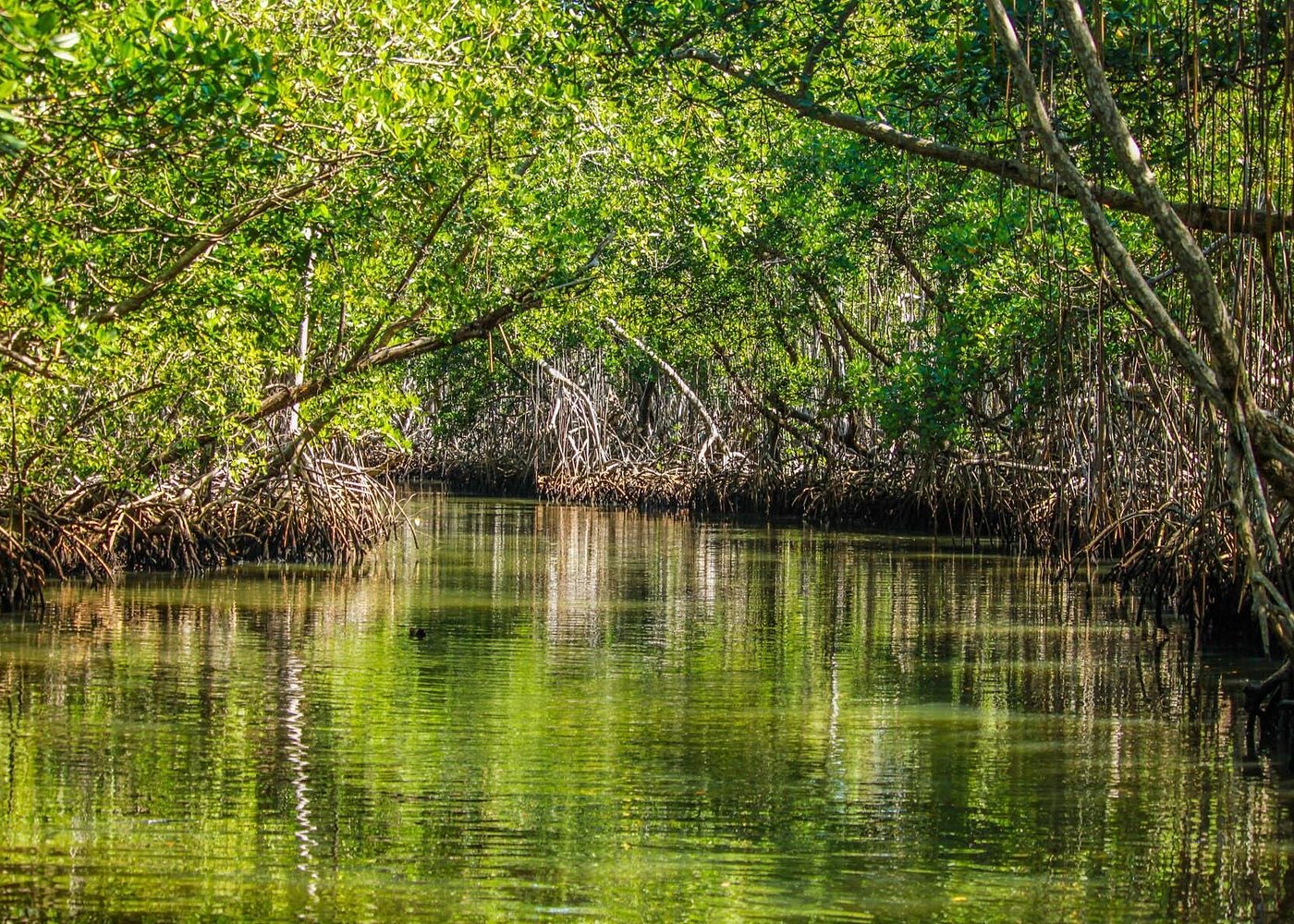
Mangroves are among the most recognizable ecosystems of Los Haitises. These salt-tolerant coastal trees grow in areas influenced by tidal water and changing salinity.
The park's management plan identifies the mouth of the Barracote River as a major mangrove location. It also reports that red mangrove is dominant in this area, with some trees reaching considerable height.
A scientific study of mangrove regeneration in Los Haitises examined a forest in the broad delta formed by the mouths of the Yuna and Barracote rivers. The researchers described a mangrove community dominated by red mangrove and white mangrove, with a smaller amount of black mangrove.
These species are adapted to different environmental conditions, including differences in flooding, salinity and soil characteristics.
Red mangrove
Red mangrove (Rhizophora mangle) is recognizable by its distinctive supporting roots. These roots help anchor the tree in soft, waterlogged ground.
In the Barracote river-mouth environment, red mangrove is particularly important because it is reported as the dominant mangrove species in the park management plan.
White mangrove
White mangrove (Laguncularia racemosa) is another species recorded in the wider Los Haitises delta forest. Its presence contributes to the diversity of the mangrove community.
Black mangrove
Black mangrove (Avicennia germinans) was also recorded in the scientific study, although in smaller amounts than the other principal species described.
The distribution of mangrove species can vary from one location to another. It is therefore better to understand these records as descriptions of a studied forest rather than assume that every species occurs in equal numbers throughout the park.
4. How River Sediment Can Influence Mangrove Growth
Sediment is a natural part of river and coastal ecosystems. Rivers transport particles from their drainage areas, and some of this material can settle in slower-moving water near river mouths.
This can gradually alter the shape and depth of shallow coastal areas.
Research using remote sensing to examine mangrove changes around Samaná Bay reported an increase in mangrove cover near the mouth of the Barracote River between the satellite observation periods examined. The researchers associated this expansion with sediment deposition, which reduced water depth and helped mangrove propagules establish across a wider area.
This is an important example of how physical changes in a coastal environment can influence vegetation.
However, sediment deposition is not automatically beneficial everywhere. Excessive or polluted sediment can damage aquatic habitats, change water circulation and create ecological problems. The effects depend on the amount, composition and location of the deposited material.
Healthy coastal ecosystems require a balance between natural sediment movement, water circulation and suitable conditions for mangrove growth.
5. The Relationship Between the Barracote and the Yuna River
The Barracote is connected to a wider river-management and drainage system involving the Yuna River.
According to the Dominican National Geographic Institute's publication on surface hydrographic resources, an artificial channel was constructed to connect the Barracote with the Yuna. The purpose was to help evacuate high flows from the Yuna.
The publication explains that water distribution between the original Yuna outlet and the Barracote route varies with seasonal conditions. During wetter months, water can be distributed through both outlets, while lower-flow conditions can change how much water moves through each route.
This connection is important when interpreting the coastal landscape. The Barracote's hydrology cannot always be understood as the result of rainfall falling directly within its immediate surroundings. Water-management infrastructure and the wider Yuna drainage network also influence the system.
This is one reason why river and wetland conservation needs to consider connected catchments rather than treating each watercourse as an entirely separate feature.
6. Freshwater, Tides and Coastal Conditions
Mangrove environments are influenced by both freshwater and seawater.
Freshwater can arrive through river drainage, rainfall and groundwater discharge. Tidal seawater moves through coastal channels and affects the flooding patterns of mangrove soils.
The balance between these water sources helps determine the environmental conditions in which mangroves grow.
Salinity is especially important. Some mangrove species tolerate a wider range of salinity than other plants, allowing them to survive in coastal environments where conditions change over time.
Water movement also influences the distribution of sediment, nutrients and organic material. When tidal channels remain connected, water can circulate through the mangrove environment. Changes to drainage or channel connections may affect these processes.
The Barracote river-mouth landscape is therefore part of a dynamic coastal system rather than a fixed arrangement of riverbanks and trees.
7. Why Mangroves Matter for Wildlife
Mangrove forests provide important habitat for many forms of coastal and wetland life.
Their submerged roots, muddy ground and sheltered channels create different ecological spaces. Fish and small aquatic organisms may use mangrove areas for feeding, shelter or parts of their life cycles. Crabs and other invertebrates are also associated with mangrove environments.
The trees provide resting, nesting or feeding opportunities for some birds, depending on the species and location.
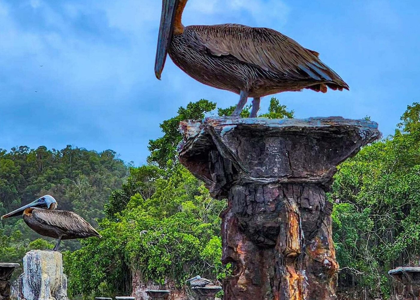
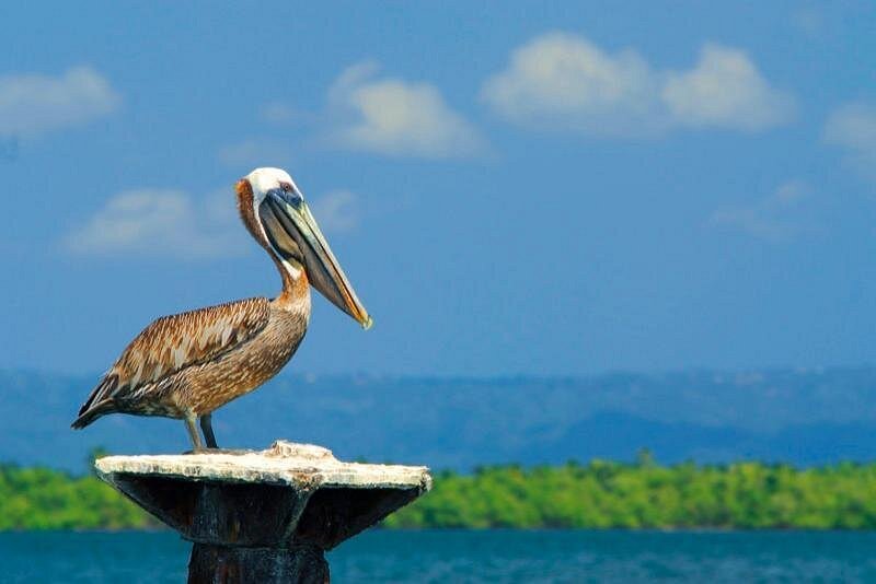
The official Dominican Republic tourism description of Los Haitises highlights the park's mangroves, coastal cays and birdlife, including pelicans, herons and egrets.
These general park records should not be interpreted as a guarantee that every bird or animal will be seen near the Barracote River. Wildlife distribution changes with season, water conditions and habitat.
For visitors, the most responsible approach is to observe wildlife quietly and avoid disturbing vegetation or animals.
8. Mangroves as Natural Coastal Protection
Mangroves can help reduce some forms of coastal erosion and wave energy. Their roots and trunks create physical resistance to moving water, while the forest structure can encourage suspended particles to settle under suitable conditions.
This does not mean that mangroves prevent every form of coastal damage. Their protective effects depend on forest width, vegetation condition, water depth, wave exposure and local coastal geography.
In a landscape such as Los Haitises, mangroves are valuable because they form part of a wider network of wetlands, river mouths and coastal habitats.
Protecting these forests also helps maintain the natural character of the park's shoreline.
9. Environmental Pressures on the Barracote River Landscape
River-mouth ecosystems can be affected by changes across the wider drainage area.
Potential pressures include:
- Excessive sediment entering coastal waters.
- Pollution carried by surface runoff.
- Removal or degradation of mangrove vegetation.
- Changes to natural drainage and water circulation.
- Development or land-use changes in surrounding areas.
- Disturbance caused by poorly managed activities.
These pressures should be assessed using reliable local monitoring rather than assumptions based on appearance alone.
Historical satellite research has documented both mangrove loss in some parts of the wider Samaná Bay landscape and mangrove expansion near the Barracote mouth. This shows that coastal vegetation can change significantly over time and that conditions are not identical across the region.
Conservation efforts should therefore focus on maintaining water quality, protecting existing mangrove forests and monitoring changes in coastal habitats.
10. Can Visitors Explore the Barracote River?
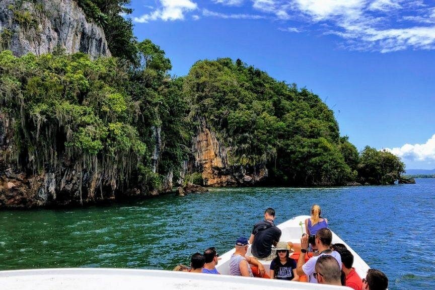
Los Haitises is commonly explored through authorized boat excursions and selected nature activities. The official Dominican Republic tourism website describes boat trips and kayaking through the park's mangrove system as visitor experiences.
However, this does not establish that every river, channel or mangrove area is open to visitors.
Before planning a trip specifically around the Barracote River, ask an authorized tour operator or the relevant park authority whether the proposed route is permitted and currently accessible.
Visitors should also follow basic conservation practices:
- Do not cut, collect or damage mangrove roots or branches.
- Avoid throwing rubbish into rivers or channels.
- Do not feed or chase wildlife.
- Keep noise low around bird habitats.
- Follow the guide's instructions and remain on authorized routes.
- Do not enter restricted areas without permission.
A responsible visit helps protect the habitats that make Los Haitises distinctive.
11. Why the Barracote River Matters to the Future of Los Haitises
The Barracote River is important because it illustrates the connection between inland drainage, coastal processes and mangrove ecosystems.
Its river-mouth environment is part of a larger deltaic landscape influenced by the Yuna system. Sediment movement can change shallow coastal areas, while freshwater and tidal conditions influence mangrove growth.
These processes are not separate. They interact to shape the wetlands and coastal habitats associated with Los Haitises.
Protecting the Barracote's mangrove environment therefore requires attention to the wider water system, including river connections, sediment movement, water quality and coastal vegetation.
Los Haitises is best understood as a connected natural landscape. The Barracote River is one important part of that story.
Frequently Asked Questions
1. Where is the Barracote River?
The Barracote River is part of the lower Yuna and Samaná Bay drainage landscape in the Dominican Republic. Its river-mouth environment is associated with mangrove habitats near Los Haitises National Park.
2. Is the Barracote River connected to Los Haitises National Park?
Yes. The park's management plan identifies the Barracote river mouth as one of the principal locations of mangrove habitat within Los Haitises.
3. What mangroves grow near the Barracote River?
Research in the wider Los Haitises delta describes red mangrove and white mangrove as dominant species in the studied forest, with black mangrove present in smaller amounts.
4. Why are mangroves important around the Barracote River?
Mangroves provide habitat for aquatic organisms and birds, help retain sediment under suitable conditions and contribute to coastal protection.
5. Does the Barracote River connect with the Yuna River?
An artificial channel was constructed to connect the Barracote and Yuna systems. Official hydrographic documentation describes how this connection influences the distribution of water between their outlets.
6. Does sediment help mangroves grow?
Sediment deposition can create shallow, suitable surfaces where mangrove propagules establish. However, excessive or polluted sediment can also damage coastal ecosystems.
7. Can tourists visit the Barracote River?
Do not assume that every section is open to visitors. Confirm the specific route and access permissions with an authorized operator or park authority before booking.
8. What wildlife lives in the Barracote mangroves?
Mangrove habitats can support fish, crabs, other invertebrates and wetland birds. Specific sightings near the Barracote depend on location and season.
9. Are the Barracote River mangroves protected?
The Barracote river-mouth mangroves are identified within the Los Haitises National Park management context. Visitors should follow park regulations and avoid damaging the vegetation.
10. Why should the Barracote River ecosystem be conserved?
Its river-mouth habitats are connected to mangroves, wetlands and the wider coastal environment. Protecting these connections helps maintain biodiversity and the ecological functions of Los Haitises.
Conclusion
The Barracote River offers an important perspective on the natural systems of Los Haitises National Park. Its connection with the wider Yuna drainage network, its river-mouth mangroves and the movement of coastal sediment all contribute to the area's changing landscape.
The mangroves around the Barracote are not simply trees along the water. They are part of a complex ecosystem shaped by freshwater, tides, sediment and coastal conditions.
Understanding this relationship helps visitors appreciate why protecting rivers and mangroves together is essential for the long-term conservation of Los Haitises.
Local explorer & expert guide in Samana Whale Watching Tour.