How Tides Shape the Mangrove Channels of Los Haitises National Park: Water Movement, Flooding and Coastal Ecology
The mangrove channels of Los Haitises National Park are constantly influenced by the movement of coastal water. Their water levels rise and fall, shallow forest floors become flooded and exposed, and currents move through narrow passages between mangrove trees. These changes are part of the natural tidal cycle that helps shape the park's coastal environment.
Tides are especially important in places where seawater meets rivers and wetlands. In Los Haitises, this relationship can be seen around the coastal areas connected to Samaná Bay and the river-influenced landscapes near the Yuna and Barracote river mouths.
Understanding tides helps explain why mangrove channels have changing water depths, why some forest areas flood more regularly than others, and how coastal organisms experience their habitat.
This guide explores how tidal movement works, how it interacts with river water, and why the changing water levels matter to the mangrove environment of Los Haitises.
1. What Are Tides?
Tides are the regular rise and fall of sea level caused mainly by the gravitational attraction of the Moon and, to a lesser extent, the Sun, together with the movement of the Earth.
As the position of the Moon and Sun changes, coastal water levels follow repeating patterns. Many locations experience two high tides and two low tides during a lunar day, although the timing and size of the tides vary from one coastline to another.
Tides are not identical everywhere. Local coastline shape, water depth, bays, channels and other geographical features influence how tidal water moves.
In Los Haitises, tidal movement is important because parts of the coastal landscape contain low-lying mangrove forests, tidal channels and river-influenced wetlands.
2. How Tides Reach the Mangrove Channels of Los Haitises
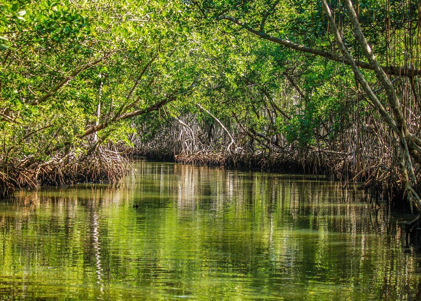
Mangrove channels connect coastal water with the sheltered areas between trees and along the shoreline.
When coastal water rises, tidal water can move into suitable channels and low-lying forest areas. As the tide falls, water drains back toward the larger channels and coastal waters.
This creates a repeated pattern of flooding and drainage.
The extent of tidal flooding depends on the elevation of the ground, the shape and depth of the channels, the density of vegetation and the connection between a particular forest area and the coast.
Not every mangrove area is flooded to the same depth or at the same time. Some locations are directly exposed to tidal water, while others receive water less frequently or are more strongly influenced by rainfall and river flows.
A study of the mangrove forest at the western end of Samaná Bay, inside Los Haitises National Park, reported a mean tidal amplitude of approximately 0.6 metres at its study site. This is a site-specific research figure, not a fixed measurement for every channel in the park.
3. The Difference Between High Tide and Low Tide
The changing water level affects the appearance and conditions of mangrove channels.
What happens during high tide?
During high tide, coastal water levels rise. Water can move farther into connected channels and flood low-lying areas of the mangrove forest.
Depending on the location, this may:
- Cover exposed muddy ground.
- Submerge lower sections of mangrove roots.
- Allow aquatic organisms to move into shallow forest areas.
- Carry suspended particles and organic material through channels.
- Connect some shallow pools and channels with surrounding coastal water.
For visitors travelling through permitted waterways, high water may make certain shallow passages more navigable. However, actual access depends on the route, boat, local conditions and operator instructions.
What happens during low tide?
During low tide, the water level falls and water drains from parts of the mangrove system.
Some muddy surfaces may become exposed, while shallow channels become less deep. Areas that were underwater during high tide may become visible.
Low tide can also reveal the shapes of mangrove roots and sediment surfaces that are normally submerged.
This does not mean that every channel becomes dry. Deeper waterways may retain water throughout the tidal cycle.
4. Why Mangrove Forest Floors Flood and Dry
Mangrove trees grow in coastal environments where water levels change regularly. Their ability to tolerate waterlogged sediment is one reason they can survive in places unsuitable for many ordinary land plants.
The amount of flooding experienced by a mangrove forest depends largely on its position in the coastal landscape.
Forests near the shoreline
Mangroves growing along exposed coastal edges may receive tidal water frequently. Their roots and lower trunks experience repeated changes in water coverage.
Riverbank mangroves
Mangroves growing beside river channels may be affected by both tides and freshwater flow. Water levels can change because of the sea, river discharge or both.
Inland mangrove areas
Some mangrove stands farther inland may experience less frequent tidal flooding. Rainfall, drainage and local ground elevation can become especially important.
These different flooding conditions help explain why mangrove forests can have different structures and species compositions even within the same broad coastal region.
5. How Tides Interact with the Yuna and Barracote Rivers
The coastal landscape around Los Haitises is influenced by both seawater and freshwater.
The Yuna and Barracote rivers contribute water and sediment to the western part of Samaná Bay. Near their lower reaches, river channels and coastal waters form an interconnected environment.
Tides influence water movement near river mouths, while river discharge carries freshwater toward the bay.
The interaction changes with weather and river conditions.
During periods of strong river flow
Heavy rainfall in a river basin can increase freshwater discharge. This can affect water levels, current strength, sediment transport and the distribution of freshwater and saltwater.
During lower river flow
When river discharge decreases, tidal water may have a stronger influence in some lower river sections and connected coastal channels.
Where freshwater and seawater meet
The mixing of freshwater and seawater creates changing salinity conditions. The exact location of this mixing zone can move according to tides, river discharge, rainfall and channel shape.
The result is a dynamic coastal environment rather than a system in which freshwater and seawater remain permanently separated.
6. What Is Tidal Exchange?
Tidal exchange is the movement of water into and out of a coastal habitat as tides rise and fall.
In a mangrove system, this movement can connect the forest with nearby rivers, estuaries, lagoons and coastal waters.
Water entering a mangrove channel may carry suspended sediment, dissolved substances and organic particles. When water moves out again, it can transport some of these materials toward the larger coastal environment.
Tidal exchange is not simply a matter of filling and emptying channels. It also influences how materials move through the ecosystem.
The amount of exchange varies according to the channel network, vegetation, water depth and local tidal conditions.
7. How Tides Affect Salinity in Mangrove Channels
Salinity describes the concentration of dissolved salts in water. It is an important environmental factor for mangrove trees and aquatic organisms.
In Los Haitises, salinity conditions can be influenced by several processes:
- Seawater entering through coastal channels.
- Freshwater arriving from rivers.
- Rainfall entering the mangrove forest.
- Evaporation from shallow water and wet sediment.
- Drainage and water exchange between connected habitats.
When more seawater enters a channel, salinity may increase. When freshwater discharge or rainfall becomes stronger, salinity may decrease.
However, these changes do not happen equally across the entire forest. A channel close to the coast may have different salinity conditions from an inland wetland or riverbank area.
This variation helps create different ecological conditions across the mangrove landscape.
8. How Tidal Movement Influences Sediment
Tides move water through channels, and moving water can transport sediment.
In some places, currents carry fine particles into sheltered mangrove areas. When water slows down among roots and vegetation, some particles may settle onto the forest floor.
As sediment accumulates, the shape and elevation of the ground can gradually change.
At other locations, stronger currents may move sediment away from the channel bed or shoreline.
The overall result depends on several interacting factors:
- Current speed and direction.
- Channel depth and shape.
- Sediment size and availability.
- Mangrove root density.
- River discharge.
- Wave activity and storms.
Research on the wider Bay of Samaná has documented how river sediment, coastal processes and extreme weather events influence the bay's changing shoreline and sediment conditions.
This wider coastal evidence helps explain why the mangrove environment around Los Haitises should be understood as part of a changing river-and-bay system.
9. Why Tidal Flooding Matters to Mangrove Wildlife
Changing water levels influence the habitat available to aquatic organisms.
During higher water, some shallow forest areas become accessible to fish and other aquatic animals. When the tide falls, water may retreat into deeper channels and pools.
This changing environment creates different feeding and shelter opportunities.
Fish
Some fish use shallow coastal habitats for feeding or shelter. The movement of water can allow them to enter or leave areas that are not accessible at every stage of the tide.
Crabs
Crabs live on muddy surfaces, among roots and in small burrows. Their activity is influenced by water coverage, sediment moisture and the timing of tidal exposure.
Molluscs and other invertebrates
Some organisms attach to roots or live within the sediment. Their exposure to water, oxygen and feeding conditions can change with the tidal cycle.
Coastal birds
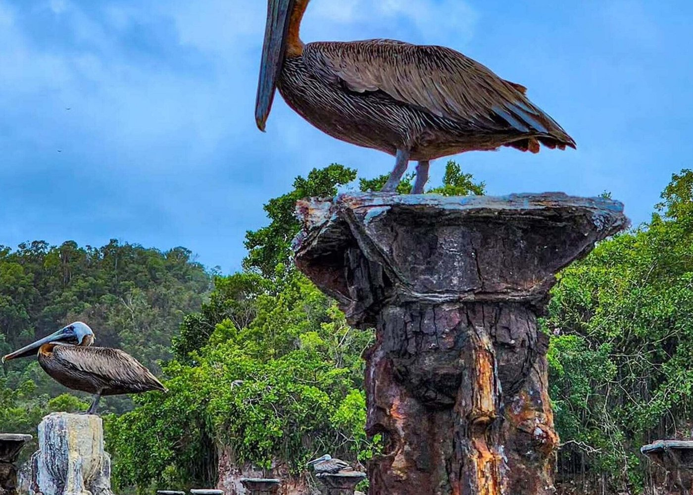
Wading birds may take advantage of exposed shallow areas and mudflats to search for food. Their feeding opportunities can change as water levels rise and fall.
These are general ecological relationships found in mangrove and coastal habitats. The exact species and behavior observed at a particular Los Haitises location depend on local conditions and the season.
10. The Relationship Between Tides and Mangrove Roots
Mangrove roots experience repeated changes in water coverage.
Red mangroves have distinctive prop roots that extend from their trunks and branches into the sediment. At higher water levels, more of these structures may be submerged.
Black mangroves can develop upright breathing roots called pneumatophores. These may project above the sediment and are adapted to the poorly aerated conditions found in waterlogged soils.
The tidal cycle changes how much of these structures is underwater or exposed to air.
This relationship is important because mangrove roots need to function in an environment where sediment can remain saturated and oxygen availability underground may be limited.
The trees' specialized root systems help them survive these conditions.
11. Tides, Rainfall and Seasonal Water Changes
Tides are a regular influence, but they are not the only reason water levels change in Los Haitises.
Rainfall can increase freshwater entering rivers, wetlands and low-lying coastal areas. During wetter periods, some locations may experience additional flooding beyond the normal tidal cycle.
During drier periods, lower freshwater input and greater evaporation can influence water depth and salinity.
Storms can also produce unusually high coastal water levels, stronger currents and additional sediment movement.
These influences may occur together. For example, a high tide during heavy rainfall and increased river discharge may produce different conditions from a high tide during a dry period.
It is therefore important not to treat every flood or water-level change in a mangrove channel as a tidal event.
12. How Visitors Can Observe Tidal Changes Responsibly
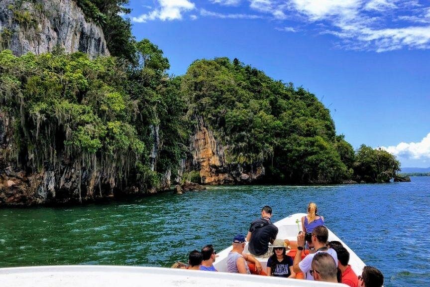
A guided boat excursion through permitted waterways can provide an opportunity to observe mangrove channels and their changing water conditions.
Visitors may notice differences in:
- How much of the mangrove roots are underwater.
- The depth of shallow channels.
- Whether muddy surfaces are exposed.
- The direction in which water moves.
- How easily a boat passes through a particular route.
A single visit cannot reveal the entire tidal cycle. To understand how the same location changes, observations would need to be made at different stages of the tide.
Visitors should never leave authorized routes or walk onto sensitive muddy surfaces to inspect exposed roots or wildlife.
Responsible observation includes:
- Following the guide's instructions.
- Keeping waste out of the water.
- Avoiding damage to roots and vegetation.
- Not disturbing wildlife.
- Respecting restrictions on landing and access.
- Checking current tour and park arrangements before travelling.
13. Why Understanding Tides Helps Protect Los Haitises
Tidal movement is part of the natural functioning of coastal mangrove ecosystems. It helps control when water enters and leaves low-lying areas, influences the movement of sediment and contributes to changing salinity conditions.
If natural water connections are blocked or significantly altered, some mangrove areas may no longer receive the same patterns of flooding and drainage.
Changes to river flows, drainage channels, coastal development and sediment movement can also affect the wider system.
Protecting mangroves therefore requires more than preserving trees. It also means understanding the water pathways that keep the ecosystem connected.
In Los Haitises, the relationship between tides, rivers, wetlands and coastal channels is an important part of the park's natural landscape.
Frequently Asked Questions
1. Do tides affect the mangrove channels of Los Haitises?
Yes. Tidal water influences connected coastal channels and low-lying mangrove areas, producing changes in water depth and flooding.
2. How high are the tides in Los Haitises?
A scientific study of a mangrove forest at the western end of Samaná Bay inside the park reported a mean tidal amplitude of approximately 0.6 metres at that study site. This should not be treated as a measurement for every location or every day.
3. What happens to mangroves during high tide?
Water levels rise, and connected low-lying forest areas may become flooded. More of the roots and muddy ground may be covered by water.
4. What happens during low tide?
Water drains from some shallow areas, exposing muddy surfaces and parts of the mangrove root systems. Deeper channels may remain flooded.
5. Do tides affect the Yuna River?
Tidal influence can extend into lower river and estuarine environments. The extent of this influence changes with river discharge, coastal water levels and local channel conditions.
6. Does tidal water make mangrove water salty?
Seawater entering through coastal channels can increase salinity. However, river discharge and rainfall can dilute it, so salinity varies across the mangrove system.
7. Why do mangrove channels have different water depths?
Water depth depends on tidal level, ground elevation, channel shape, river flow, rainfall and drainage. These factors differ from one location to another.
8. Can visitors explore mangrove channels at any tide?
Not necessarily. Suitable routes and access depend on local water levels, boat conditions, operator arrangements and current park rules. Visitors should follow authorized guides rather than assume every channel is accessible.
Conclusion
Tides help shape the mangrove channels of Los Haitises National Park by controlling the regular movement of coastal water into and out of connected forest areas.
As water levels rise and fall, mangrove roots are covered and exposed, shallow areas flood and drain, and water moves through channels linking the forest with rivers and coastal waters.
These processes influence salinity, sediment movement and the habitat available to fish, crabs, birds and other organisms.
Understanding tides provides a deeper appreciation of the park's mangroves. Their ecological importance depends not only on the trees themselves, but also on the natural movement of water through the coastal landscape.
Local explorer & expert guide in Samana Whale Watching Tour.